What Is a Prompt Engineer and How Can You Become an AI Prompt Engineer?
What is an AI Prompt Engineer, what skills are required, and how to enter Prompt Engineering? A complete, practical, and future-oriented guide.
A Review of How Drones Measure Distance and Which AI Models They Use for Detection
"Distance estimation in drones is one of the fundamental challenges in intelligent navigation. In this article, together with me, Ashkan Mostofi, we will explore it."
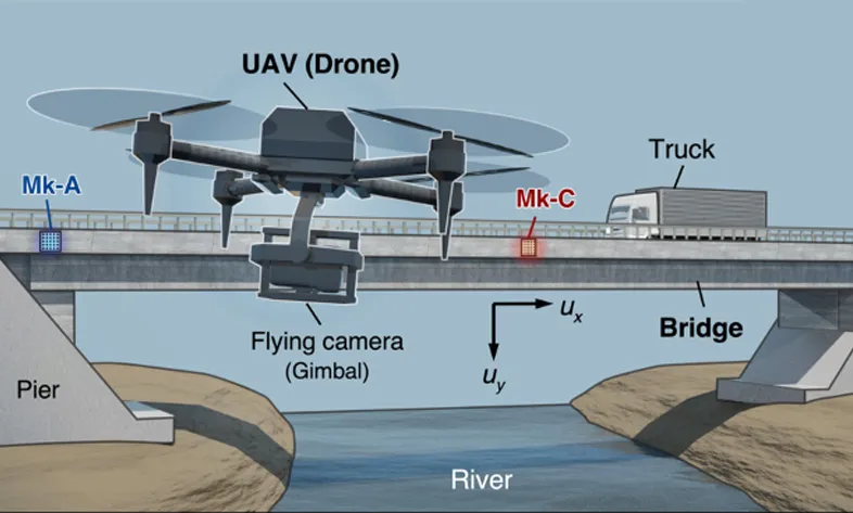
A drone needs to continuously and accurately calculate its distance from the ground, obstacles, and surrounding objects to move safely.
In this article, How Do Drones Estimate Distance?, we examine AI-based technologies, machine vision, LiDAR, SLAM mapping, and deep algorithms used for distance estimation in drones.
Recent advancements in artificial intelligence and machine vision have enabled modern drones to detect distance and avoid obstacles with extremely high accuracy.
In the past, drones relied only on simple sensors such as ultrasonic detectors, but today they use deep learning models, neural networks, stereo vision, SLAM algorithms, and even LiDAR to build real-time 3D maps.
This article fully explains how these technologies estimate distance and in which conditions each one performs best.
Many small drones—where weight and power consumption matter—use only a single camera.
But a 2D image has no real depth, so how is distance estimated?
This is where AI comes in.
Models such as MiDaS, DPT, DenseDepth, and Vision Transformer–based architectures can generate a depth map from a single image.
These models are trained with millions of real-world images and have learned to identify depth patterns.
The result is medium-accuracy but extremely lightweight processing—ideal for mini and commercial drones.
In Stereo Vision, a drone uses two cameras functioning like human eyes.
By calculating the disparity between pixel positions in two synchronized images, the exact distance of each point in the scene is determined.
AI algorithms used to improve this estimation include PSMNet, GA-Net, and RAFT-Stereo.
This method offers extremely high accuracy and is used in advanced drones such as the Mavic and Autel series.
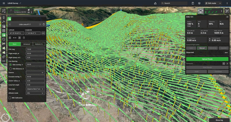
LiDAR is the most accurate method for measuring distance.
By sending laser pulses and measuring their return time, it generates a highly precise 3D map of the environment.
Artificial intelligence fuses LiDAR data with camera and IMU data (Sensor Fusion) to produce more stable and robust mapping.
Important algorithms include Kalman Filter + Deep Learning and BEV Fusion models, also used in self-driving cars.
SLAM stands for “Simultaneous Localization and Mapping.”
A drone uses its camera, IMU, and sometimes laser sensors to build a map of the environment in real time while estimating its distance from obstacles.
Modern SLAM models use neural networks to detect features and improve stability.
Examples include:
This method is essential for drones operating in complex environments such as forests, tunnels, industrial sites, and indoor spaces.
In some cases, the goal is not exact distance measurement but early obstacle detection.
Networks such as YOLOv8 and DETR detect objects, and then geometric and deep-learning models estimate their approximate distance.
This method is extremely fast and suitable for collision avoidance.
Drones estimate distance with remarkable accuracy by combining artificial intelligence, machine vision, sensors, and advanced algorithms.
Choosing the right technique depends on the drone type, weight, cost, and application.
With the rapid advancement of deep-learning models, the future of drones is moving toward fully autonomous and safe navigation.
Can a drone estimate distance using only a camera?
Yes. With Monocular Depth AI models such as MiDaS, this is possible.
What is the most accurate method for measuring distance?
LiDAR is the most accurate method, but it is heavier and more expensive than camera-based approaches.
Is SLAM alone enough for stable flight?
SLAM is usually combined with IMU and camera data to improve stability.
Source » itroz academy


What is Generative AI? A Simple and Complete Guide: From AI Basics to Architectures, Examples, Risks, and Applications — For Readers with No Prior Knowledge.

What AI models does a physical humanoid robot need? From perception and vision to decision-making, motion control, memory, and safety considerations.


What is Generative AI? A Simple and Complete Guide: From AI Basics to Architectures, Examples, Risks, and Applications — For Readers with No Prior Knowledge.

How to build a strong professional network and grow your career with practical techniques and examples for career advancement and professional skills.

Comments (0)